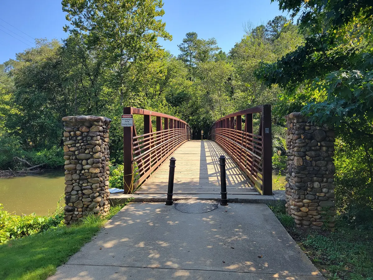
River Park and Brookshire, Woodstock's north end at I-575 Exit 9, are zoned for Woodstock Elementary, Middle and High. Olde Rope Mill Park is next door.
Last checked Oct. 6, 2026. Sources: the City of Woodstock’s 2023 Comprehensive Plan (PDF) and its GIS map layers, the Cherokee County School District’s boundary maps, the state’s 2025 School Grades data, Zillow Research and OpenStreetMap. City Hall: 770-592-6000.
The city’s north end is two groups of subdivisions on either side of I-575, north of Ridgewalk: Brookshire to the west and the River Park developments to the east, along the Little River and Holly Springs Parkway. Olde Rope Mill Park is between them and the outlet mall.
What this means for you
- Zoned high school: Woodstock High for every address, with Woodstock Elementary and Woodstock Middle. Check one address with the district at 770-479-1871.
- Home value: $465,240 in ZIP 30188 and $449,993 in ZIP 30189 in August 2026, according to the Zillow Home Value Index.
- Nearest interstate exit: I-575 Exit 9, Ridgewalk Parkway, about 1.1 miles by road.
Part of our Woodstock neighborhoods guide.
Where it is
This is the part of the city north of Ridgewalk, up to the city line. I-575 splits it. West of the interstate is Brookshire; east of it are the River Park developments off Holly Springs Parkway, with the Little River to the south. The City of Holly Springs is to the north. In our mapping, 53% of buildings are in ZIP code 30189, all of them west of I-575, and 47%, all east of it, in 30188.
The city’s 2023 Comprehensive Plan splits the buildings here between Suburban Living, 53%, where “housing is consistently detached” on larger lots, and Neighborhood Living, 47%, “homes on small lots, using interconnected streets,” which “may include some attached housing.”
Homes
The city’s subdivision map names Brookshire, at about 280 acres the largest subdivision on the city’s map, and five River Park developments: River’s Edge at River Park, about 71 acres, Water’s Edge at River Park, The Ridge at River Park, The Glens at River Park and The Commons at River Park. We found no city HOA registry, so this page does not list HOAs.
Schools
The Cherokee County School District’s boundary maps put every building here in the Woodstock feeder pattern. Scores are 2025 College and Career Ready Performance Index (CCRPI) figures from the state’s School Grades data.
| Level | School | Address | 2025 CCRPI |
|---|---|---|---|
| Elementary | Woodstock Elementary (report card) | 230 Rope Mill Road | 83.6 |
| Middle | Woodstock Middle (report card) | 2000 Towne Lake Hills South Drive | 87.7 |
| High | Woodstock High (report card) | 2010 Towne Lake Hills South Drive | 89.6 |
The district scored 87.0 and the state 78.0. Check an address on the district’s maps page or at 770-479-1871. More in our Woodstock schools guide.
Home values
The typical home value in ZIP 30188 was $465,240 in August 2026, down 1.3% from $471,185 in August 2025, and in ZIP 30189 $449,993, down 2.5% from $461,305, according to the Zillow Home Value Index. The citywide Woodstock figure was $456,827, down 1.9%. The index is a modeled typical value for the middle third of homes, not a sale price, and each ZIP code covers much more than this area. More in our home prices guide.
Parks and trails
Olde Rope Mill Park, 690 Olde Rope Mill Road, is on the Little River at the area’s southern edge, according to the city’s parks page:
- 14 miles of mountain bike trails, the Taylor Randahl Memorial Mountain Bike Trails, also open to hikers and runners
- Paddling, fishing and a water route on the Little River
- The Trestle Rock Trail, about 0.4 mile along the river past the ruins of the rope mill
- Picnic areas and a rock pavilion
Check SORBA Woodstock for trail status after rain. More in our parks and trails guide.
Getting around
- I-575: Exit 9, Ridgewalk Parkway, about 1.1 miles by road; Exit 8, Towne Lake Parkway, about 2.8 miles. OpenStreetMap shows Exit 11, Sixes Road, just north of the city line.
- Downtown: about 3.1 miles to the Park at City Center.
- Airport: about 42 miles to Hartsfield-Jackson Atlanta International Airport.
- These are distances on the OpenStreetMap road network, measured with the OSRM routing engine from the middle of the area, not drive times.
- Transit: Xpress commuter buses list no Woodstock stop. More in our getting around guide.
Groceries and everyday stores
From OpenStreetMap, the nearest supermarkets are north and east of the area:
- Publix, 6175 Holly Springs Parkway, with a pharmacy
- Kroger, 5339 Old Highway 5
- Costco, 113 Lincoln St., in Ridgewalk
How we drew this area
This area is every part of the city north of latitude 34.1295, on both sides of I-575. School shares, ZIP codes and character areas come from the buildings mapped in OpenStreetMap inside it, matched to the district’s countywide boundary maps and the Census Bureau’s ZIP code areas. Store and park locations are © OpenStreetMap contributors.
Frequently asked questions
What schools serve River Park and Brookshire in Woodstock?
Woodstock Elementary, Woodstock Middle and Woodstock High, according to the Cherokee County School District’s boundary maps. Confirm an address with the district at 770-479-1871.
Is River Park in Woodstock a good place to live?
Here are the facts. River Park and Brookshire are single-family subdivisions at the city’s north end, next to Olde Rope Mill Park and about a mile from I-575 Exit 9. They are zoned for Woodstock High, which scored 89.6 on the state’s 2025 CCRPI. Zillow put the typical home value at $465,240 in ZIP 30188 and $449,993 in ZIP 30189 in August 2026.
What ZIP code is Brookshire in Woodstock?
- In our mapping, the north end splits almost evenly: Brookshire, west of I-575, is in ZIP 30189, and River Park, to the east, in 30188.
How far is River Park from downtown Woodstock?
About 3.1 miles by road from the middle of the area to the Park at City Center, measured on the OpenStreetMap road network.
Have your say