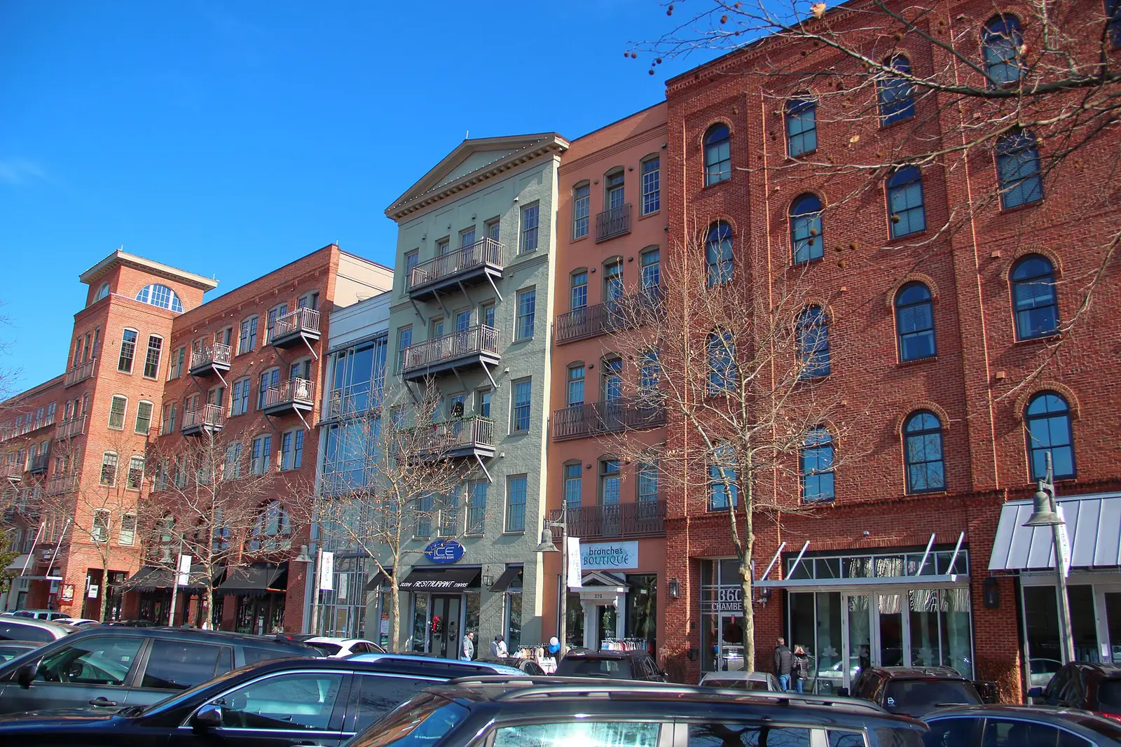
Downtown Woodstock is zoned for Woodstock Elementary, Middle and High and sits in ZIP 30188, where the typical home value was $465,240 in August 2026.
Last checked Oct. 6, 2026. Sources: the City of Woodstock’s 2023 Comprehensive Plan (PDF) and its GIS map layers, the Cherokee County School District’s boundary maps, the state’s 2025 School Grades data, Zillow Research and OpenStreetMap. City Hall: 770-592-6000.
Downtown is the old center of Woodstock: Main Street, the railroad, City Hall’s park and the streets of houses, townhomes and apartments around them. The city’s comprehensive plan calls its core the Urban Core, the character area that “embodies the heart of Woodstock,” and rings it with an Urban Village of homes, shops and services.
What this means for you
- Zoned high school: Woodstock High for the whole area, with Woodstock Elementary and Woodstock Middle. Check one address with the district at 770-479-1871.
- Home value: $465,240 in ZIP 30188 in August 2026, according to the Zillow Home Value Index.
- Nearest interstate exit: I-575 Exit 8, Towne Lake Parkway, about 0.7 mile by road.
Part of our Woodstock neighborhoods guide.
Where it is
This page covers the City of Woodstock’s Downtown District, a boundary the city publishes on its GIS map service, north of a line about a third of a mile above Highway 92. The district’s southern end, along South Main Street, has its own page.
Main Street runs north and south through the middle. Towne Lake Parkway comes in from I-575 on the west, Arnold Mill Road leaves to the northeast and Rope Mill Road to the northwest. I-575 is the western edge. Every building we mapped here is in ZIP code 30188.
The city’s 2023 Comprehensive Plan puts about 70% of the area’s buildings in the Urban Village character area, which it describes as “predominately residential, incorporating moderate density housing and allowing retail and services that serves residents’ day-to-day needs.” About 10% are in the Urban Core and 19% in Suburban Living. The plan calls Towne Lake Parkway “a unique and significant opportunity for the expansion of downtown and the creation of a gateway for visitors approaching downtown from I-575,” and lists a downtown street grid of new roads and connections among its transportation projects.
Homes
The city’s subdivision map names more than 30 developments inside the area. The largest are Serenade, Sherwood Forest, Haney Walk, Cardinal Woods and Dobbs Estates. Closer to Main Street the map names townhome and apartment developments such as Mason Main, Linton & Main, Woodstock Seven, Walton Woodstock, Whispering Trace Apartments and Downtown on Dupree Apartments. The map does not list which have a homeowners association, and we found no city HOA registry, so this page does not list HOAs.
Schools
The Cherokee County School District’s boundary maps put the whole downtown area in one feeder pattern. Scores are 2025 College and Career Ready Performance Index (CCRPI) figures from the state’s School Grades data.
| Level | School | Address | 2025 CCRPI |
|---|---|---|---|
| Elementary | Woodstock Elementary (report card) | 230 Rope Mill Road | 83.6 |
| Middle | Woodstock Middle (report card) | 2000 Towne Lake Hills South Drive | 87.7 |
| High | Woodstock High (report card) | 2010 Towne Lake Hills South Drive | 89.6 |
The Cherokee County School District scored 87.0 and the state 78.0. Boundaries are set by the school board each year; confirm an address on the district’s maps page or at 770-479-1871. More in our Woodstock schools guide.
Home values
The typical home value in ZIP 30188 was $465,240 in August 2026, down 1.3% from $471,185 in August 2025, according to the Zillow Home Value Index. The citywide Woodstock figure was $456,827, down 1.9%. The index is a modeled typical value for the middle third of homes, not a sale price, and the ZIP code covers much more than downtown. More in our home prices guide.
Parks and trails
From the city’s parks page:
- The Park at City Center, 101 Arnold Mill Road: gazebo, fountain, memorials and the Northside Hospital-Cherokee Amphitheater.
- The Downtown Playground, 111 Elm St., with an accessible boardwalk and climbing dome.
- Woofstock Park, 150 Dupree Road: large and small dog parks and trailheads for the Noonday Creek Trail and Towne Lake Pass.
- Dobbs Road Nature Trail, 200 Dobbs Road, a wooded path to the amphitheater parking lot.
- Community Garden, 311 Arnold Mill Road.
The Noonday Creek Trail starts at Market Street and runs south to Highway 92. The Woodstock Public Library is at 7735 Main St. More in our parks and trails guide.
Getting around
- I-575: Exit 8, Towne Lake Parkway, about 0.7 mile by road; Exit 7, Highway 92, about 1.8 miles; Exit 9, Ridgewalk Parkway, about 2.1 miles.
- Airport: about 40 miles to Hartsfield-Jackson Atlanta International Airport.
- These are distances on the OpenStreetMap road network, measured with the OSRM routing engine from the middle of the area, not drive times.
- Transit: Xpress commuter buses list no Woodstock stop. Parking, transit and trail links are in our getting around guide.
Groceries and everyday stores
From OpenStreetMap:
- Woodstock Pharmacy, 8612 Main St.
- Kroger, 2295 Towne Lake Parkway, west of I-575
- Sprouts Farmers Market, 1430 Towne Lake Parkway
- Walgreens, 950 Towne Lake Parkway
The city’s shopping center map lists an Ingles at Woodstock Square on South Main Street.
How we drew this area
This area is the city’s Downtown District layer north of latitude 34.0935, about a third of a mile north of Highway 92. School shares, ZIP codes and character areas come from the buildings mapped in OpenStreetMap inside it, outside the city’s mapped shopping and business centers, matched to the district’s countywide boundary maps and the Census Bureau’s ZIP code areas. Store and park locations are © OpenStreetMap contributors.
Frequently asked questions
What schools are zoned for downtown Woodstock?
Woodstock Elementary, Woodstock Middle and Woodstock High, according to the Cherokee County School District’s boundary maps. Woodstock Elementary is downtown at 230 Rope Mill Road. Confirm any address with the district at 770-479-1871.
Is downtown Woodstock a good place to live?
Here are the facts. Downtown is the city’s Urban Core and Urban Village character areas, with apartments, townhomes and houses within walking distance of Main Street, zoned for Woodstock High, which scored 89.6 on the state’s 2025 CCRPI. The typical home value in ZIP 30188 was $465,240 in August 2026, according to Zillow.
What ZIP code is downtown Woodstock?
- Every building we mapped in the downtown area is in ZIP code 30188.
How far is downtown Woodstock from the Atlanta airport?
About 40 miles by road to Hartsfield-Jackson Atlanta International Airport, by I-575 and I-75. That is a distance on the road network, not a drive time.
Have your say